Events
In Depth: The Events Shaping Our Campus and Beyond
Use of GIS, Remote Sensing and Spatial Statistics in Research
PAST EVENT
28
JUN
2018
The seminar will assist members on how to use already developed maps in their research. Due to time limitation, the seminar will be a combination of few practicals and more of demonstrations. Participants will be required to use ArcGIS which has been installed on 12 computers in room 34, so please come in good time to get familiar with the machines. We therefore encourage some participants to bring their laptops if they have the software already installed.
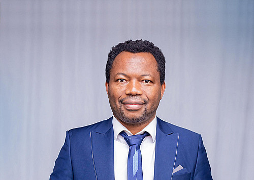
The presenter will be Mr. Peter Mkwanda - an experienced GIS expert who is currently doing his PhD in South Africa.